








The next tropical storm could impact the U.S. just a week after Henri drenched parts of the Northeast and knocked out power to tens of thousands of people.
Related: Logistics groups ready to help during potentially busy hurricane season
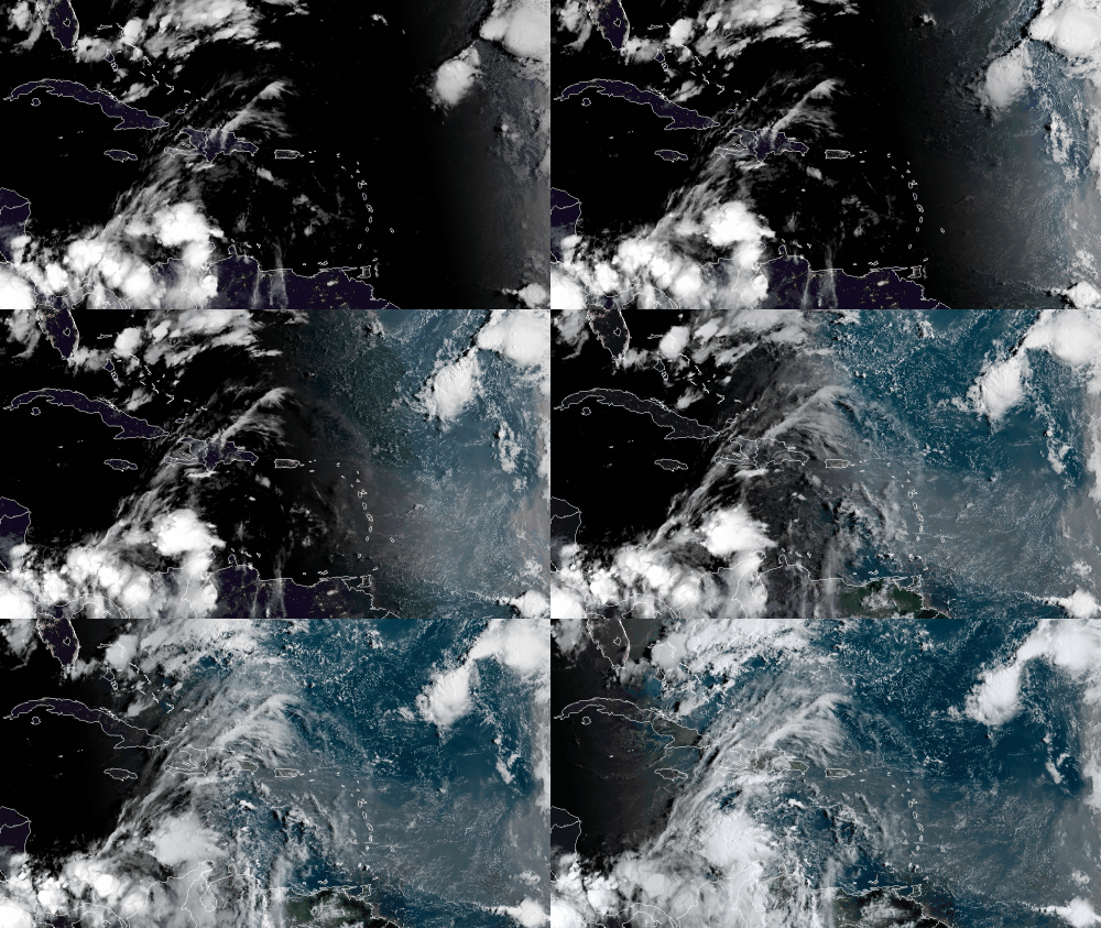
A cluster of thunderstorms in the Caribbean off the Colombian coast has caught the attention of meteorologists at the National Hurricane Center. They expect the system to become more organized over the next few days, giving it an 80% chance of becoming a tropical storm over the weekend.
Environmental conditions — very warm waters and fairly low levels of wind shear — are forecast to be conducive for development, and a tropical depression is likely to form later this week while the system moves west across the northwestern Caribbean Sea. The NHC expects the disturbance to move near or across the Yucatan Peninsula of Mexico on Saturday, then into the western Gulf of Mexico by Sunday where conditions could be favorable for additional development into a tropical storm.
Most of the latest computer forecast models are consistent on the system developing into a named storm, steadily intensifying the system throughout its journey. As of Wednesday morning, landfall would be somewhere near the Texas-Louisiana border. However, a direct hit could happen farther west or east, anywhere from South Texas to New Orleans. This margin of error will gradually narrow over the next few days.
The timing of the impacts along the coast would be Monday and Tuesday, although impacts at ports and offshore oil rigs and platforms would begin Sunday.
Two other potential tropical storms are brewing — one in the middle of the Atlantic, the other off the West African coast — but these are not forecast to affect any land masses. They will only be a concern for container ships on the open waters. If the system heading toward the U.S. becomes a tropical storm, its name will either be Ida or Julian, depending on whether one of the other systems beats it to the punch.
Related: Long view: Preparing logistically for extreme weather
Potential lanes of concern
Interstate 10 from Houston to New Orleans
Interstate 69 from Houston to Brownsville, Texas
Click here for more FreightWaves articles by Nick Austin.
You might also like:
Ferocious California wildfire spreading toward Lake Tahoe
Top 5 US spots for truck-animal collisions
Hot Shots: Fierce fires, ferocious floods, train derailments and more
Brokerage Compliance Symposium
The day before F3. Every compliance issue you face - fraud exposure, carrier liability, FMCSA rules, cargo theft, insurance gaps - navigated by attorneys and operators defining best practices in a changing industry.
F3 Awards Dinner
The night before F3. FreightTech100 companies honored. FreightTech 25 and Shipper of Choice winners revealed live. Cocktail reception into dinner and live music - 300 industry leaders in one purpose-built room.
F3: Future of Freight Festival
Industry-defining keynotes, rapid-fire technology demos, and industry leaders networking in experiences across Chattanooga - plus the inaugural F3 Awards Dinner featuring the FreightTech and Shipper of Choice reveals.
The day before F3. Every compliance issue you face - fraud exposure, carrier liability, FMCSA rules, cargo theft, insurance gaps - navigated by attorneys and operators defining best practices in a changing industry.
The Signal at Chattanooga Choo Choo • Chattanooga, TN Register NowThe night before F3. FreightTech100 companies honored. FreightTech 25 and Shipper of Choice winners revealed live. Cocktail reception into dinner and live music - 300 industry leaders in one purpose-built room.
The Signal at Chattanooga Choo Choo • Chattanooga, TN Register NowIndustry-defining keynotes, rapid-fire technology demos, and industry leaders networking in experiences across Chattanooga - plus the inaugural F3 Awards Dinner featuring the FreightTech and Shipper of Choice reveals.
The Signal at Chattanooga Choo Choo • Chattanooga, TN Register Now